


DC-Software products
Article
DCSECTION pro
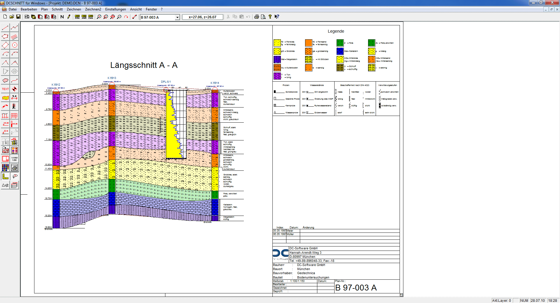
The DCSECTION pro program can be used to create geological sections automatically from a site map and supplement them with test data from the DC Soil Mechanics programs.
Screenshots
Videos
DCSection.avi
20,26MB
DCSection.wmv
22,01MB
Description
- Creation of site maps (bore point map) and geological sections based on bore profiles from DCBORE
- Insertion of maps into other maps (e. g. a small site map for overview in a longitudinal section)
- Access to individual tests of the DC Soil Mechanics programs
- Full configuration of the test representation with map-related storage
- Representation of data from a database, every modification is immediately updated on the map
- Insertion of sections on the map as polygonal lines of any shape
- Automatic creation of the longitudinal section and arrangement of the selected tests in the correct position and elevation
- Identification of layer areas of any shape with layer symbols and colours
- Representation of the layers in the section according to DIN 4023, ÖNORM B 4400-1, SN 640 034, BS 5930 and automatic creation of a key of all existing soil types
- Editing of the maps with extensive CAD functions
- Drawing sizes from DIN A4 to A0 and user-defined sizes
- Output options: printer, PDF
- Import interfaces: graphics import via bitmaps and DFX import
- Export interfaces: graphics export in JPG format, DXF export
Related products
DCSECTION light
The progam DCSECTION light can be used to create geological sections and supplement them with the test data from the DC Soil Mechanics programs.
Show detailview