


DC-Software products
Article
DC-Dewatering
The DC-Dewatering program can be used to calculate groundwater lowering with multi-well installations. The calculation can be performed for the lowering of groundwater in several adjacent excavation pits of different depths with any number of wells and in a staggered arrangement.
Screenshots
Videos
DC-Dewatering special approaches
Showing dewatering analysis with waterproof enclosure, tight base and vacuum wells
33,59MB
Description
- Any number of excavation pits can be defined with different shapes and depths
- Optional waterproof enclosure and waterproof invert
- Selection of various well systems: vertical or horizontal wells, vacuum or gravity wells, open dewatering
- Any number of wells with different diameters, depths and lowering aims
- A staggered arrangement of the wells is possible
- Optional automatic arrangement of wells with predefined diameters, depths and distances from the edge of the excavation pit (optimisation of the well location and depth)
- Horizontal soil stratification with different permeabilities
- Free, semi-confined or confined groundwater, optionally with a fixed water level from a nearby water body
- Lowering depth either predefined or adapted to the excavation depth
- Calculation and indication of the required pump water quantity, capacity, lowering and wetted filter height per well
- Calculation of the decisive point for the lowering
- Calculation of the required number of wells
- Calculation of the extent according to Sichardt, according to Weyrauch, according to Weber or time-dependent
- Consideration of the influence of the wells on each other depending on their spacing
- Calculation of the residual flows from the wall and the invert as well as the inflows from precipitation for the trough construction
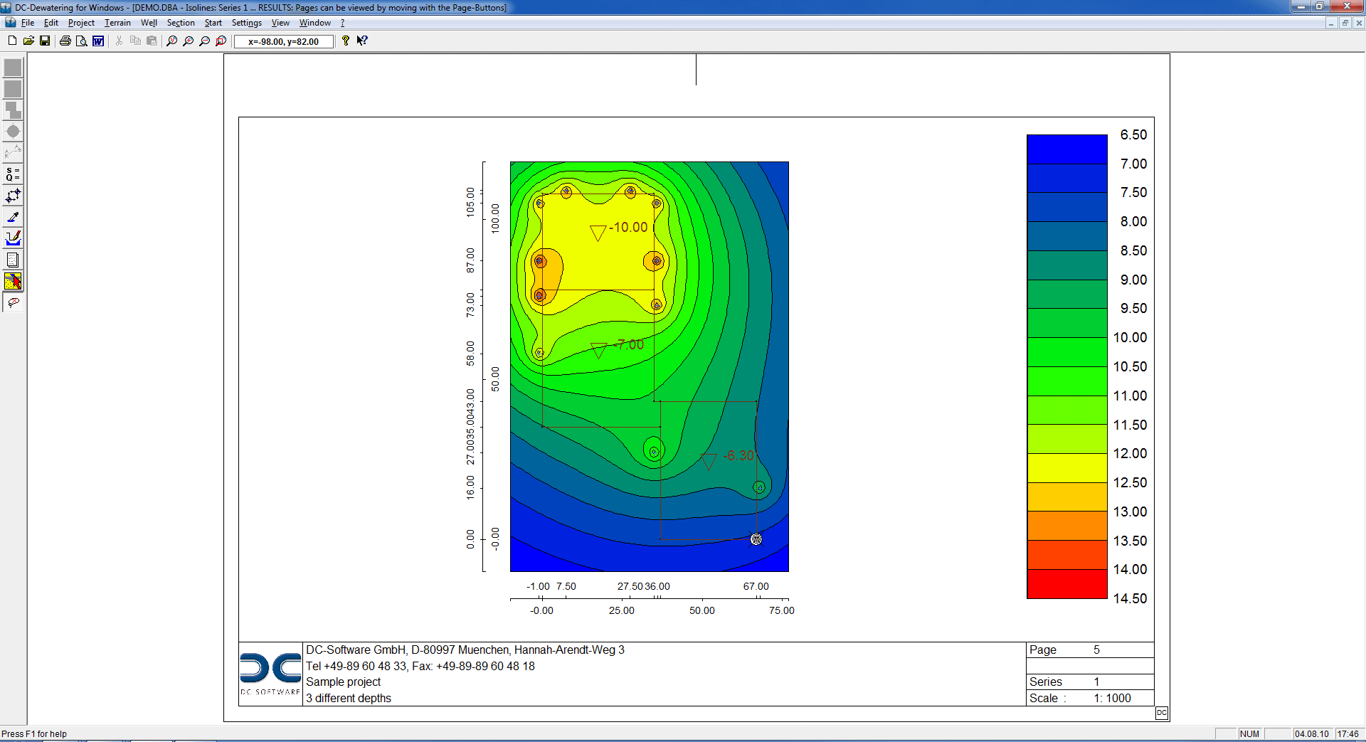
- Representation of the lowering via contour lines or coloured areas
- Representation of the water level along any section line
- The lowering can be displayed at any point in the user interface
- For the accurate internal modelling of the excavation pit dimensions, it is possible to import DXF graphics as a background.
- Output options: printer, PDF
- Interfaces: RTF export to MS Word, graphic export in JPG format, DXF export